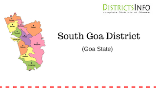
South Goa District and Talukas: South Goa is one of two districts that comprises the state of Goa in West India, within the region known as the Konkan. It is bounded by the district of North Goa to the north, the Uttara Kannada district of Karnataka state to the east and south, while the Arabian Sea forms its western coast. Goa was annexed by India on 19 December 1961. Goa and two other former Portuguese enclaves became the union territory of Goa, Daman, and Diu, and Goa was organized into a single district in 1965. On 30 May 1987, Goa attained statehood (while Daman and Diu became a separate union territory), and Goa was reorganized into two districts, North Goa and South Goa. The headquarters of the district is Margao. The district is divided into five subdivisions and seven taluks – Ponda, Mormugao, Salcete (Margao), Quepem, and Canacona (Chaudi), Sanguem, and Dharbandora. Ponda Taluka shifted from North Goa to South Goa in January 2015.
Frequent buses are available between Margao and North Goa. According to the 2011 census, South Goa has a population of 639,962. South Goa has a sex ratio of 980 females for every 1000 males, and a literacy rate of 85.53%. There are many educational institutions in South Goa. South Goa is connected by road by the National Highway 17A, by rail by the Vasco da Gama railway station, by the sea through the Mormugao Harbour and by air through Dabolim Airport, thus serving as the main hub for most tourists visiting the state of Goa. The city of Vasco falls under the boundaries of the South Goa.
South Goa District
Frequent buses are available between Margao and North Goa. According to the 2011 census, South Goa has a population of 639,962. South Goa has a sex ratio of 980 females for every 1000 males, and a literacy rate of 85.53%. There are many educational institutions in South Goa. South Goa is connected by road by the National Highway 17A, by rail by the Vasco da Gama railway station, by the sea through the Mormugao Harbour and by air through Dabolim Airport, thus serving as the main hub for most tourists visiting the state of Goa. The city of Vasco falls under the boundaries of the South Goa.
Talukas in South Goa District
| Ponda | Mormugao |
| Salcete (Margao) | Quepem |
| Canacona (Chaudi) | Sanguem |
| Dharbandora | |

