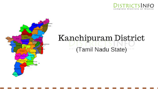
Kanchipuram District and Talukas: Kanchipuram otherwise known as Kanch is a city in the Indian state of Tamil Nadu, 72 km (45 mi) from Chennai – the capital of Tamil Nadu. Kanchipuram has been chosen as one of the heritage cities for HRIDAY - Heritage City Development and Augmentation Yojana scheme of Government of India.Kanchipuram was known in early Tamil literature as Kachi or Kachipedu but was later sanskritized to Kanchi or Kanchipuram. According to legend, the name Kanchi is derived from Ka referring to the Hindu god Brahma and anchi, referring to his worship of Hindu god Vishnu at this place. Kanchipuram is located at 12.98°N 79.71°E, 72 km (45 mi) south-west of Chennai on the banks of the Vegavathi River, a tributary of the Palar River. The city covers an area of 11.6 km 2 (4.5 sq. mi) and has an elevation of
83.2 m (273 ft.) above sea level. The land around Kanchipuram is flat and slopes towards the south and east. The soil in the region is mostly clay, with some loam, clay, and sand, which are suitable for use in construction.
Ground water is the major source of water supplies used for irrigation. Kanchipuram generally experiences hot and humid climatic conditions throughout the year. According to 2011 census, Kanchipuram had a population of 164,384 with a sex-ratio of 1,005 females for every 1,000 males. The average literacy of the city was 79.51%. The major occupations of Kanchipuram are silk sari weaving and agriculture. As of 2008, an estimated 5,000 families were involved in sari production. The main industries are cotton production, light machinery and electrical goods manufacturing, and food processing. Kanchipuram is most easily accessible by road. The Chennai – Bangalore National Highway, NH 4 passes the outskirts of the city. The city is also connected to the railway network through the Kanchipuram railway station. The nearest domestic as well as international airport is Chennai International Airport, located at a distance of 72 km from the city. Kanchipuram is traditionally a center of religious education for the Hindu, Jainism and Buddhism faiths. The city has 6 engineering colleges, 3 polytechnic institutes and 6 arts and science colleges.
Kanchipuram District
Ground water is the major source of water supplies used for irrigation. Kanchipuram generally experiences hot and humid climatic conditions throughout the year. According to 2011 census, Kanchipuram had a population of 164,384 with a sex-ratio of 1,005 females for every 1,000 males. The average literacy of the city was 79.51%. The major occupations of Kanchipuram are silk sari weaving and agriculture. As of 2008, an estimated 5,000 families were involved in sari production. The main industries are cotton production, light machinery and electrical goods manufacturing, and food processing. Kanchipuram is most easily accessible by road. The Chennai – Bangalore National Highway, NH 4 passes the outskirts of the city. The city is also connected to the railway network through the Kanchipuram railway station. The nearest domestic as well as international airport is Chennai International Airport, located at a distance of 72 km from the city. Kanchipuram is traditionally a center of religious education for the Hindu, Jainism and Buddhism faiths. The city has 6 engineering colleges, 3 polytechnic institutes and 6 arts and science colleges.
Talukas in Kanchipuram District
| Chengalpattu | Cheyyur |
| Kancheepuram | Madhuranthangam |
| Sriperumbudur | Thambaram |
| Tirukalukundram | Uthiramerur |

